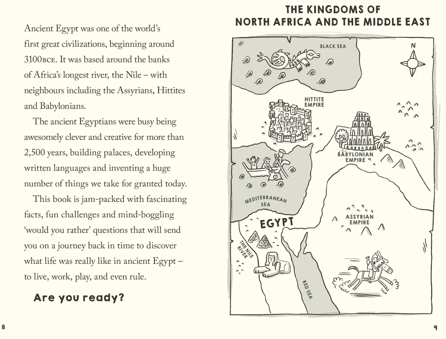
Original: $5.99
-70%$5.99
$1.80The Story
Explore new places with this comprehensive map of Ireland from Collins.
An easy-to-use route-planning map covering the whole of Ireland. It has the convenience of an atlas with all the benefits of a fold out map, and features clear, full-colour road maps at 10 miles to 1 inch, plus city centre plans of Belfast and Dublin.
The map is laminated on both sides making it durable and good value.
Features of this map include:
- Clear detailed mapping with attractive layer colours showing height
- Places of tourist interest and Tourist Information Centres shown
- Distance chart on the back of the map in both miles and kilometres
- Distances shown on the roads to aid journey planning

Details & Craftsmanship
Every detail has been carefully considered to bring you the perfect product.

Details & Craftsmanship
Every detail has been carefully considered to bring you the perfect product.

Details & Craftsmanship
Every detail has been carefully considered to bring you the perfect product.
Description
Explore new places with this comprehensive map of Ireland from Collins.
An easy-to-use route-planning map covering the whole of Ireland. It has the convenience of an atlas with all the benefits of a fold out map, and features clear, full-colour road maps at 10 miles to 1 inch, plus city centre plans of Belfast and Dublin.
The map is laminated on both sides making it durable and good value.
Features of this map include:
- Clear detailed mapping with attractive layer colours showing height
- Places of tourist interest and Tourist Information Centres shown
- Distance chart on the back of the map in both miles and kilometres
- Distances shown on the roads to aid journey planning